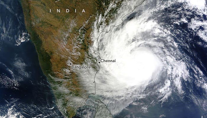
New Delhi: The US space agency NASA has released images of cyclone Vardah captured by its satellites while passing over the Bay of Bengal.
On December 11, 2016, the Moderate Resolution Imaging Spectroradiometer (MODIS) on NASA’s Terra satellite acquired a natural-color image of Vardah (above) as it churned in the Bay of Bengal.

(On Dec 11 the NASA-NOAA Suomi NPP satellite captured this natural-color image of Tropical Cyclone Vardah in the central Bay of Bengal)
Two days earlier on December 9, 2016, the Visible Infrared Imaging Radiometer Suite (VIIRS) instrument aboard the NASA-NOAA Suomi NPP satellite captured a visible image of Tropical Cyclone Vardah in the central Bay of Bengal, Northern Indian Ocean. The image image was qcquired while it was still below hurricane/cyclone force.

(On Dec 9 the NASA-NOAA Suomi NPP satellite captured a visible image of Tropical Cyclone Vardah in the central Bay of Bengal)
Cyclone Vardah, moving at a speed of 80 to 100 kmph, made landfall close to Chennai, the capital of the Indian state of Tamil Nadu, on Monday December 12, 2016.
Forecasters expect the storm to drop as much as 10 inches (25 centimeters) of rain in some areas, with the potential for flooding.


