Hampton (Virginia): Weather plays an important role in our daily lives. Receiving the correct weather information aids us in making our everyday plans ranging from daily activities to making travel arrangements.
Weather forecasts are unpredictable, which is why researchers work tirelessly to develop new technology and ways to provide timely and more accurate forecasts.
NASA's scientists and engineers at its Langley Research Center in Hampton, Virginia are combining satellite images with novel algorithms to monitor hazardous thunderstorms.
With this method, they can identify where severe winds, hail or tornadoes are more likely to occur within storm clouds.
NASA quoted Kristopher Bedka, a physical scientist at NASA Langley, who said that, “We are able to analyze the locations where severe storms most frequently occur and when they occur with unprecedented detail using commonly available satellite imagery.”
As per the US space agency, forecasters have known for years that anvil clouds indicate thunderstorms. But anvil tops can be miles wide, and it is sometimes difficult to distinguish where within those clouds hazardous weather may be occurring. Bedka said it is crucial to figure out what is a hazardous storm and what isn’t within anvil clouds, especially because strong updrafts pose serious risks for things like flying aircraft.
“You never really want to fly through turbulence, but you can’t tell a forecaster or a pilot: ‘don’t fly anywhere here,’” said Bedka as he pointed at satellite images of cloud tops over southern United States on his computer screen. “That’s half the state of Texas and all of Oklahoma, so you really want to target where within these clouds is most likely to be unsafe.”
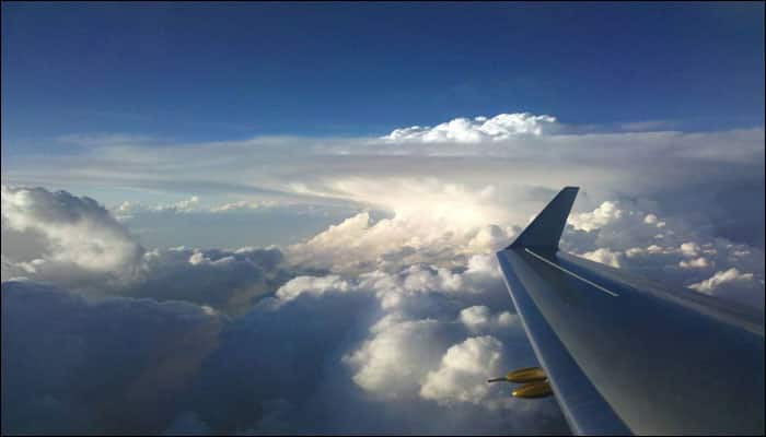
To really target the action, Bedka focuses on updrafts that are strong enough to punch into the stratosphere. That penetration creates lumpy clouds, which look almost like the top of a cauliflower sticking out from an anvil top. Known as overshooting tops, these lumps indicate areas where strong thunderstorms—sometimes hail and tornadoes—usually occur.
Although researchers know that overshooting tops indicate thunderstorms, Bedka said it is sometimes difficult to spot them quickly enough to provide warnings for severe weather. “You can see some of these clouds with your eyes in satellite imagery, but given that the images are changing so rapidly, you need a tool that can automatically identify them to make better forecasts,” he said.
“You can imagine monitoring a storm throughout its lifetime, whether it has overshooting tops and how these tops relate to weather on the ground,” Bedka said. “But you could maybe do that for like one storm, and what you really want is to identify whether there’s an entire line of severe weather events corresponding to each of those little bumps.”
Bedka works with Langley researcher Konstantin Khlopenkov. Analyzing sunlight reflected from clouds allows them to see the signature cauliflower shapes of overshooting tops. Bedka and Khlopenkov also use infrared imagers that function like night-vision goggles to detect heat. These imagers can spot overshooting tops, which emit less heat than other clouds in lower regions of the atmosphere.
To deliver almost instant forecasts, Bedka and Khlopenkov combine their satellite observations with powerful software engineering. “We can process an image that covers the entire United States in less than two minutes,” Bedka said.


