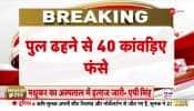
New Delhi: Heavy showers in eastern Rajasthan wreaked havoc as roads were damaged and rail tracks got washed out in Jodhpur division.
The India Meteorological Department (IMD) has issued a red alert for parts of Rajasthan and Madhya Pradesh. Fairly widespread to widespread rainfall with isolated heavy to very heavy rain is very likely over west Uttar Pradesh between August 1 and 2.
Light to moderate rains drenched the neighbouring states even as intense rainfall activity has been predicted for the next few days in parts of north and central India.
Delhi received an average of 43.6 mm of rain till 8.30 am as the mercury reached a high of 34.4 degrees Celsius. Due to heavy rains in the last few days, a portion of a road under the IIT-Delhi flyover caved in disrupting traffic.
However, in a sigh of relief, the water level in the Yamuna river receded below the danger mark of 205.33 on Saturday morning, a day after the Delhi administration sounded a flood alert and expedited efforts to evacuate people living in the river floodplains.
The water level was recorded at 205.01 metres at the Old Railway Bridge at 8 am. It was 205.44 metres at 1 am and 205.20 metres at 6 am.
On Friday, the Delhi Police started evacuating people living on the floodplains of the Yamuna in the capital as Haryana discharged more water into the river from the Hathnikund Barrage.
The weather department has issued a yellow alert in the national capital for Sunday and an orange alert for Monday.
Light to moderate rain occurred at many places in Uttar Pradesh with Lakhimpur Kheri recording the highest maximum temperature of 35.5 degrees Celsius. Rainfall was recorded in Chitrakoot, Etawah, Etah, Auraiya, Firozabad, Sonbhadra, Agra and Lalitpur districts.
In Punjab and Haryana, the maximum temperatures hovered close to normal limits with some places in both the states witnessing rainfall. Chandigarh, the joint capital of the two states, recorded a maximum temperature of 35 degrees Celsius and traces of rainfall.
Widespread rainfall was recorded in eastern parts of Rajasthan inundating roads in many places and washing out railway tracks Gudha and Govindi Marwar station in Jodhpur division.
Several roads were inundated in Jaipur, Dausa, Tonk, Sawaimadhopur, Karauli, Dholpur and Baran.
Due to a well-marked low-pressure area and a monsoon trough, fairly widespread to widespread rainfall with isolated heavy to very heavy rainfall is likely over east Madhya Pradesh on July 31-August 1 and over Chhattisgarh and east Uttar Pradesh on July 31.
Widespread rainfall with isolated heavy to very heavy falls are very likely to continue over east Rajasthan and west Madhya Pradesh from July 31 to August 4 with peak activity from July 31 to August 3.
The current spell of fairly widespread to widespread rainfall activity is very likely to continue over parts of north India with isolated heavy falls over Jammu and Kashmir on July 31, Punjab on August 1, Himachal Pradesh till August 2 and Uttarakhand and Haryana till August 4, the IMD said.