New Delhi: With the formation of a cyclonic circulation/ low-pressure system over West Bengal and neighbourhood on 19th /20th June and its movement towards southwest Uttar Pradesh, conditions are becoming favourable for further advancement of monsoon over west UP and rest of Northwest India, according to India Meteorological Department.
Monsoon is likely to cover most parts of Northwest India during 21-25 June. It is likely to cover: 1. West Uttar Pradesh and Uttarakhand during 21-22 June; 2. North-east Rajasthan and eastern parts of Haryana and Delhi during 22-23 June; 3. HP, East Rajasthan, and Some parts of (west Rajasthan, Punjab, J&K) during 23-24 June.
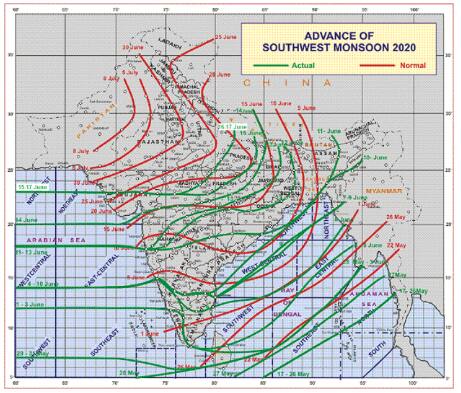
The National Weather Forecasting Centre/Regional Meteorological Centre, New Delhi of the India Meteorological Department (IMD) said that the Northern Limit of Monsoon (NLM) continues to pass through Kandla, Ahmedabad, Indore, Raisen, Khajuraho, Fatehpur, and Bahraich, according to Ministry of Earth Science.
It further said that a cyclonic circulation lies over East Uttar Pradesh and neighbourhood and extends up to 3.6 km above mean sea level.
"A trough at mean sea level runs from central Pakistan to Bangladesh and extends up to 0.9 km above mean sea level. A cyclonic circulation lies over north Konkan and neighbourhood between 3.1 and 7.6 km above mean sea level. A shear zone at 3.1 km above mean sea level runs from Jharkhand to the cyclonic circulation over the Konkan region," said the statement.
It further informed that "widespread rainfall activity very likely along the West Coast with isolated heavy to very heavy falls over coastal Karnataka on 17th and 21st June and over Konkan and Goa 17th and 18th and heavy falls over coastal Karnataka during 18-20th June and over Konkan and Goa during 19-21st June."
Widespread rainfall with isolated heavy to very heavy falls very likely over Northeast, East, and adjoining Central India during the next 5 days.
1. Isolated to fairly widespread rainfall with isolated thunderstorms, lightning, and gusty winds very likely over the Western Himalayan Region and plains of northwest India during 19th-21st June.
2. Heatwave to severe heatwave conditions over West Rajasthan and heatwave conditions over East Rajasthan and Punjab during the next 2-3 days.
Monsoon likely to reach Delhi by June 22-23
Meanwhile, India Meteorological Department (IMD) today said that the monsoon is likely to reach the national capital three to four days earlier than the usual date of June 27.
Kuldeep Srivastava, the head of the regional forecasting centre of the IMD, told PTI that a cyclonic circulation over West Bengal and the neighbourhood will move towards southwest Uttar Pradesh by June 19 and June 20.
"It will help in further advancement of the monsoon in west Uttar Pradesh, some parts of Uttarakhand, northeast Rajasthan and eastern Haryana between June 22 and June 24," he was quoted as saying.
The IMD has predicted normal rainfall (103 per cent) for northwest India this year.