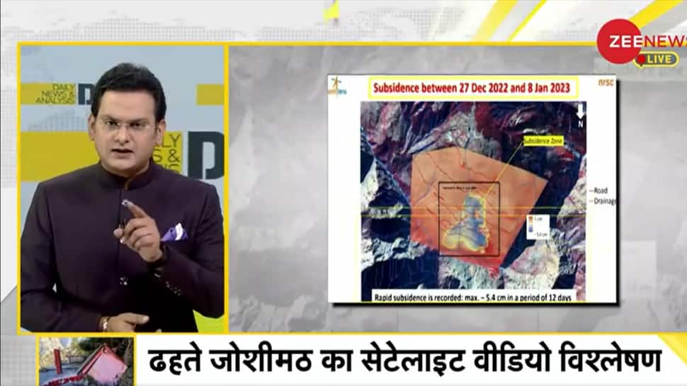
New Delhi: The Indian Space Research Organisation (ISRO) on Friday released satellite images of Joshimath and a preliminary report on land subsidence which shows that the entire town may sink. The pictures are taken from the Cartosat-2S satellite. According to the report, the land subsidence was slow between April and November 2022, during which Joshimath had sunk by 8.9 cm. But between December 27, 2022, and January 8, 2023, the intensity of land subsidence increased and the town sank by 5.4 cm in these 12 days.
In today's DNA, Zee News' Rohit Ranjan analysed the report and satelite images released by ISRO on Joshimath land subsidence.
#DNA: ISRO की तस्वीरों ने बढ़ाई जोशीमठ के लोगों की चिंता #ISRO #joshimathsinking @irohitr @vishalpandeyk pic.twitter.com/DWzCqRipv8
— Zee News (@ZeeNews) January 13, 2023
During seven months from April 2022 to November 2022, Joshimath had subsided by 9 cm and it shows that more than half of the subsidence that happened in the last seven months happened in just these 12 days.
The report reveals that the process of land subsidence is not new, it is sinking every year by about 6.62 cm i.e. about 2.60 inches.
#DNA: जोशीमठ की 'खिसकती जमीन' का Speed Test, देखिए जमीन में समाते जोशीमठ से ग्राउंड रिपोर्ट #joshimathsinking @irohitr @vishalpandeyk pic.twitter.com/rUEYofBgtN
— Zee News (@ZeeNews) January 13, 2023
The maximum subsidence has been observed near Joshimath-Auli Road at a height of about 7152 feet. This road is also going to collapse due to the land subsidence.
Watch tonight's DNA for a detailed analysis
डिजिटल इंडिया' के सरकारी स्कूलों में 'बत्ती गुल, देखिए #DNA LIVE @irohitr के साथ
+ घर-घर पहुंचते जल का 'एंटी-बायोटिक' टेस्ट
+ जोशीमठ की 'खिसकती जमीन' का Speed Test
https://t.co/NJYDS7IgxE— Zee News (@ZeeNews) January 13, 2023
This is the reason why these pictures of ISRO have increased the concerns of the people of Joshimath and now they are demanding a strong action plan with compensation from the government.


